XLS
Type of resources
Topics
Keywords
Contact for the resource
Provided by
Years
Formats
Representation types
Update frequencies
status
Scale
-
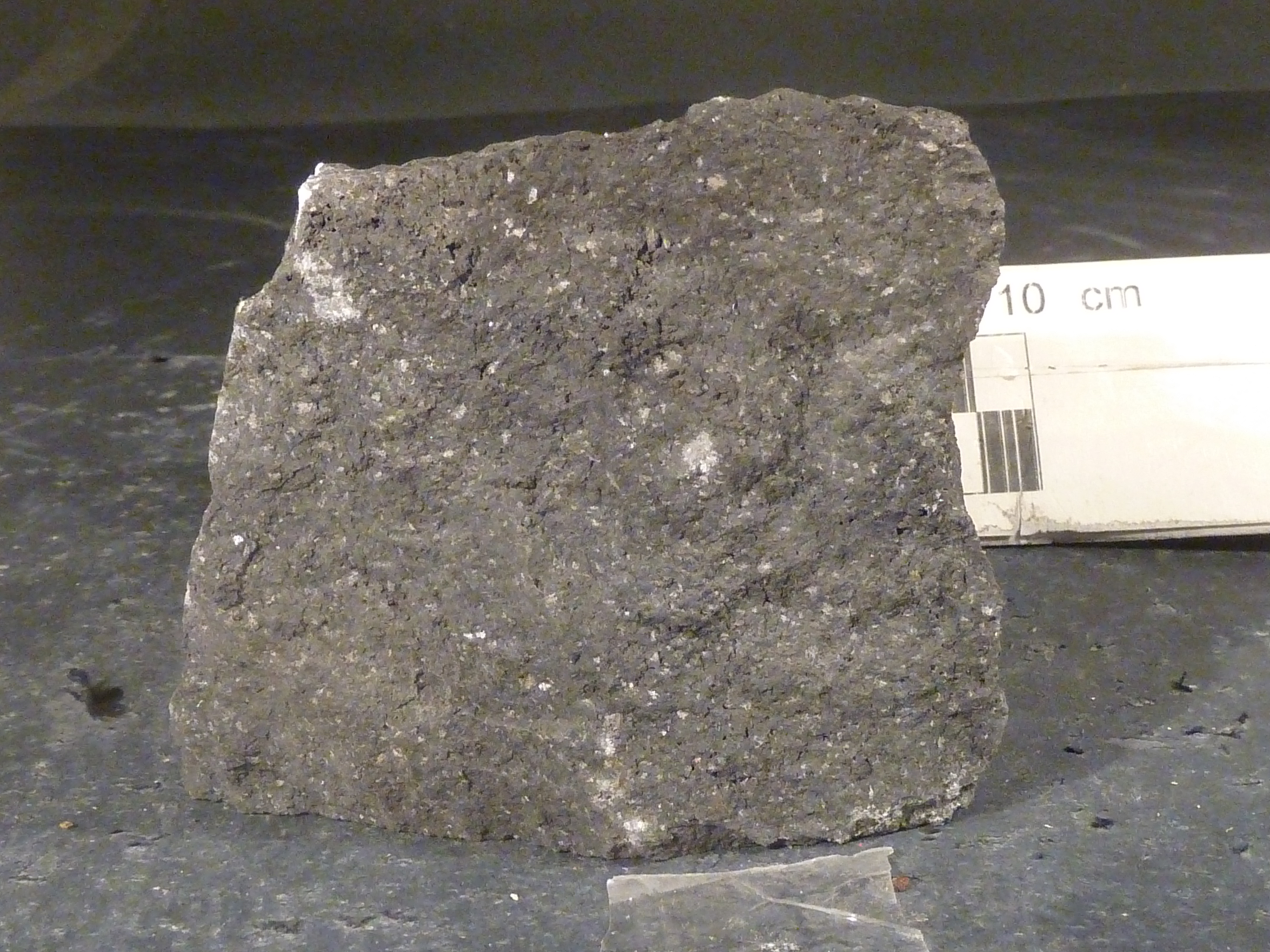
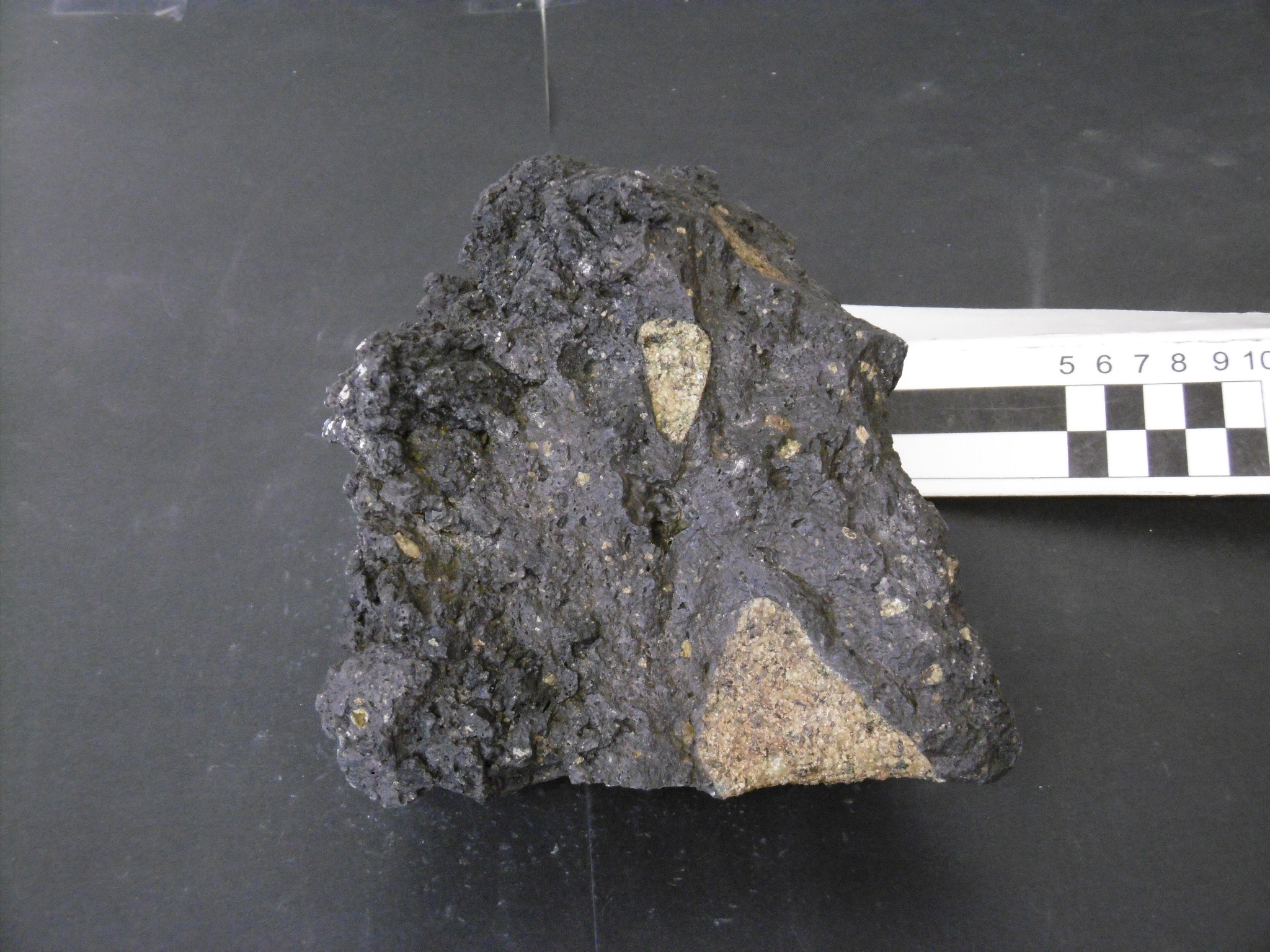
During the XIX Italian Antarctic expedition (2003/04), one tephra layer has been sampled within the aim of the project "Antarctic meteorites" in northern Victoria Land. The investigated region is within Welcome Mountain SS 55-57/4 USGS sheet.
-
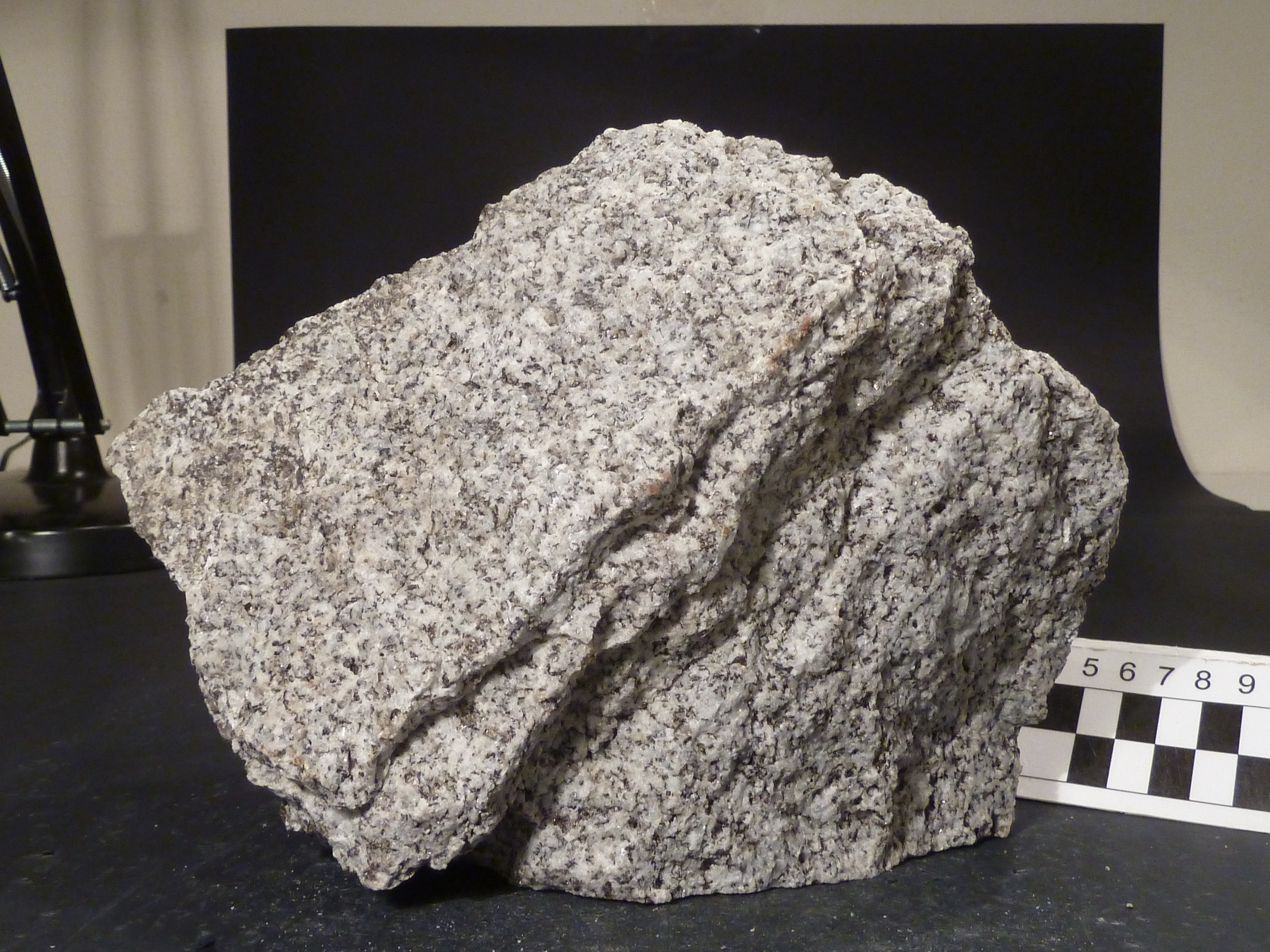
During the XII Italian Antarctic expedition (1996/97), 721 rocks have been sampled within the aim of the project "Crustal accretion in northern Victoria Land: structure, metamorphism, kinematics and chronology of the junction between Wilson, Bowers and Robertson Bay terranes" in northern Victoria Land. They include intrusive, subvolcanic, volcanic, metamorphic and sedimentary rocks. The investigated regions are within Coulman Island SS 58-60/6, Ebbe Glacier SR 57-58/16, Freyberg Mountains SS 58-60/1, Mount Murchison SS 58-60/5, Mount Soza SR 57-58/15, Ob' Bay SR 57-58/11 and Yule Bay SR 57-58/12 USGS sheets.
-
Rocks from the project “Cenozoic geodynamics in the Ross Sea area: magmatism and tectonic evolution"
During the IX Italian Antarctic expedition (1993/94), 376 rocks have been sampled within the aim of the project "Cenozoic geodynamics in the Ross Sea area: magmatism and tectonic evolution" in northern Victoria Land. They include intrusive, subvolcanic, volcanic and metamorphic rocks. The investigated regions are within Cape Hallett SS 58-60/2, Coulman Island SS 58-60/6, Mount Melbourne SS 58-60/9, Mount Murchison SS 58-60/5, Reeves Névé SS 55-57/12 and Relief Inlet SS 58-60/13 USGS sheets.
-
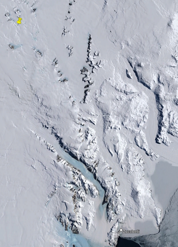
During the XXXIII Italian Antarctic expedition (2017/18), 18 rocks have been sampled within the aim of the AntMet project in northern and southern Victoria Land. They include intrusive and subvolcanic rocks and glacial deposits. The investigated regions are within Convoy Range ST 57-60/1, Reeves Névé SS 55-57/12 and Welcome Mountain SS 55-57/4 USGS sheets. Project title: Antarctic Meteorites.
-
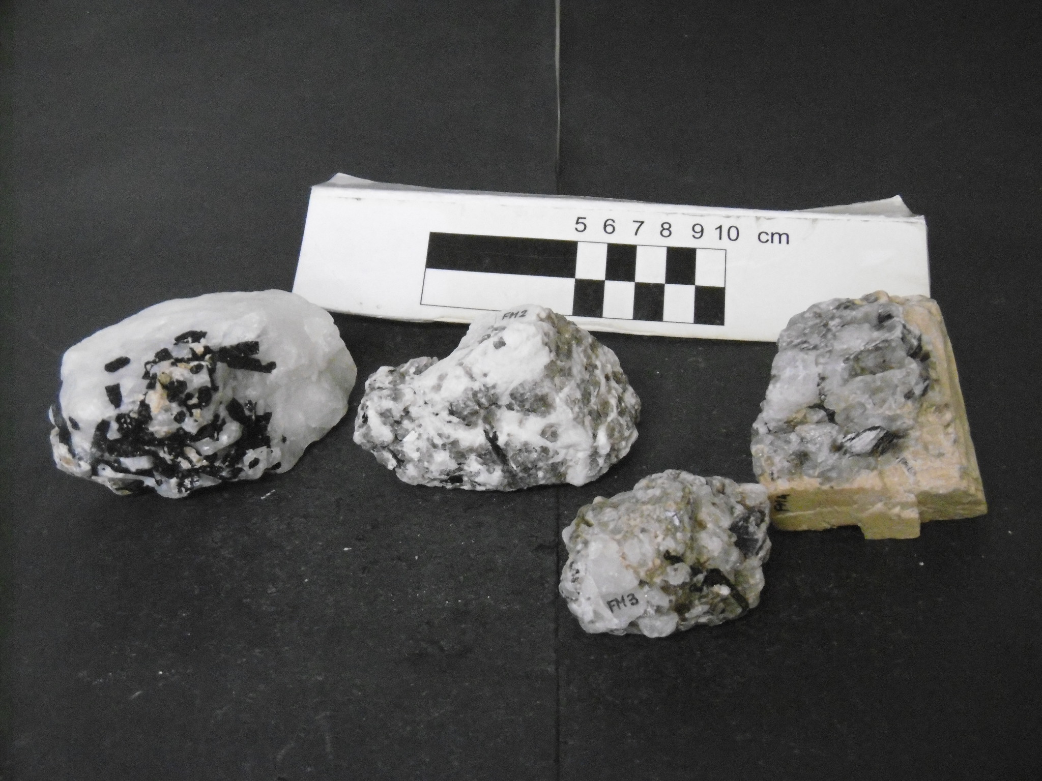
During the XXVII Italian Antarctic expedition (2011/12), 143 rocks have been sampled within the aim of the project "Xenoliths and basic lavas for the knowledge of the C-O-H system in the lithospheric mantle of the polar regions" in northern Victoria Land. They include intrusive, subvolcanic, volcanic and metamorphic rocks. The investigated regions are within Cape Hallett SS 58-60/2, Coulman Island SS 58-60/6, Mount Melbourne SS 58-60/9 and Mount Murchison SS 58-60/5 USGS sheets.
-
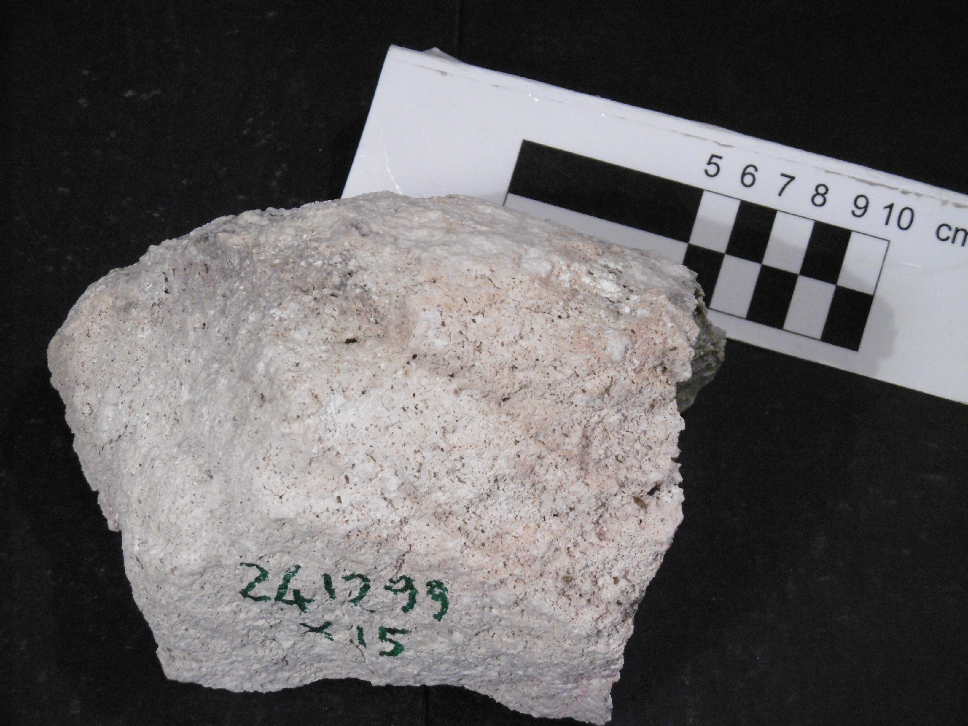
During the XV, XVI and XVII Italian Antarctic expeditions (1999/2000, 2000/01, 2001/02), 259 rocks have been sampled within the aim of the project "Cenozoic magmatism in the area north of Tucker Glacier, northern Victoria Land, Antarctica" in northern Victoria Land. They include intrusive, subvolcanic, volcanic, metamorphic and sedimentary rocks. The investigated regions are within Cape Adare SR 59-60/13*, Cape Hallett SS 58-60/2, Coulman Island SS 58-60/6, Freyberg Mountains SS 58-60/1 and Mount Melbourne SS 58-60/9 USGS sheets.
-
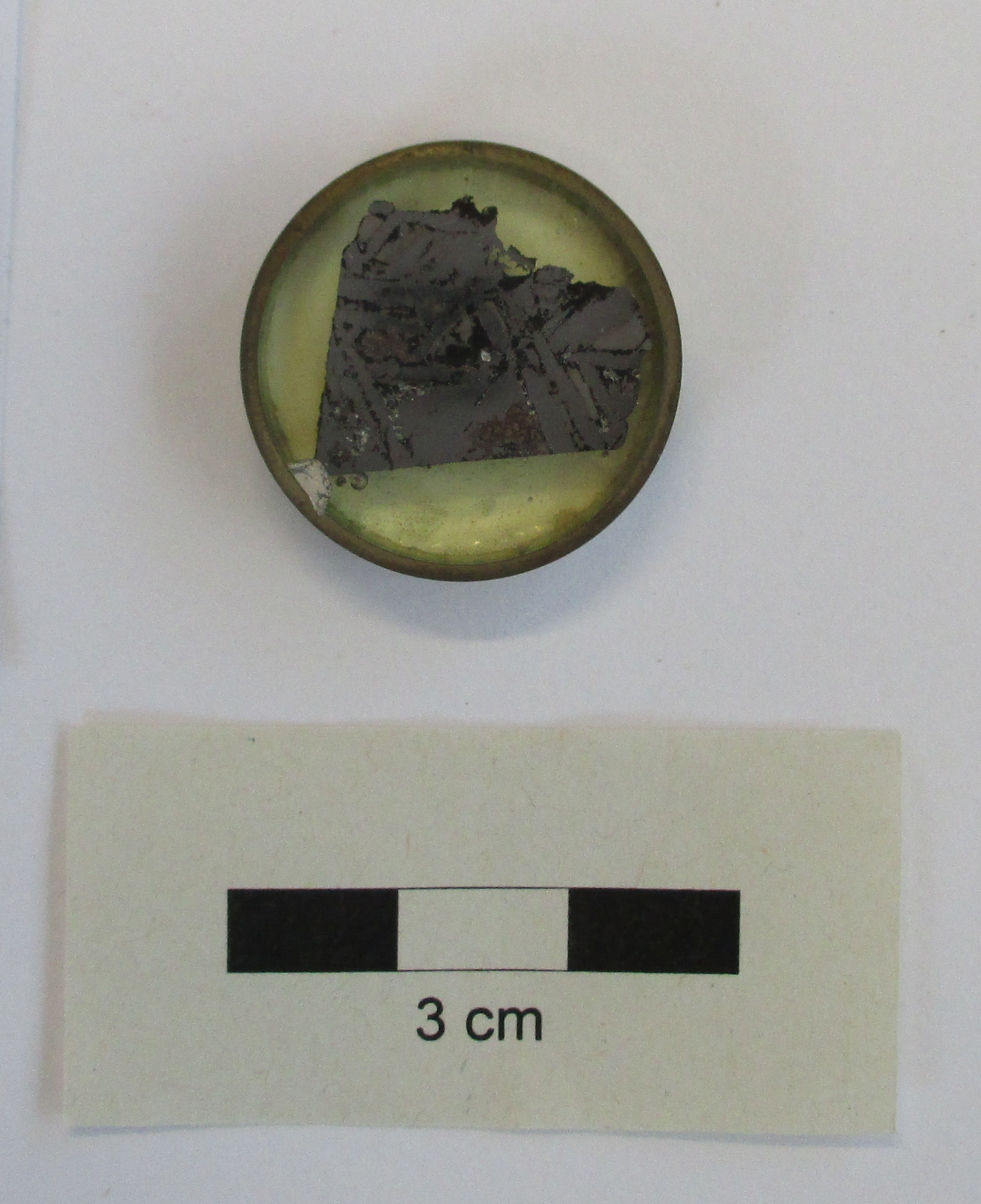
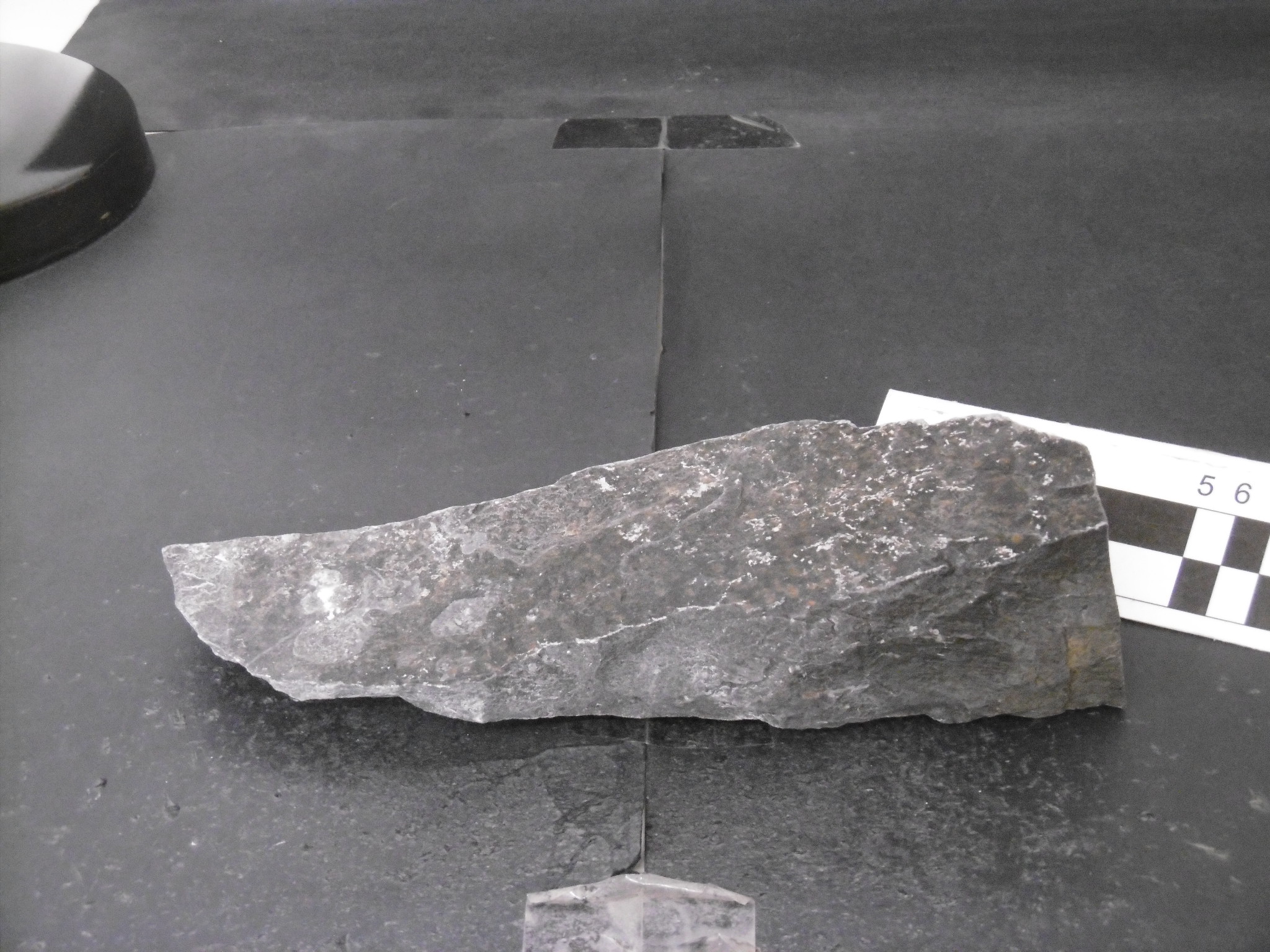
This dataset includes all the iron meteorites (achondrites) collected during the Italian Antarctic Expeditions since 1991 in Victoria Land and now preserved at the repository of the Museo Nazionale dell’Antartide.
-
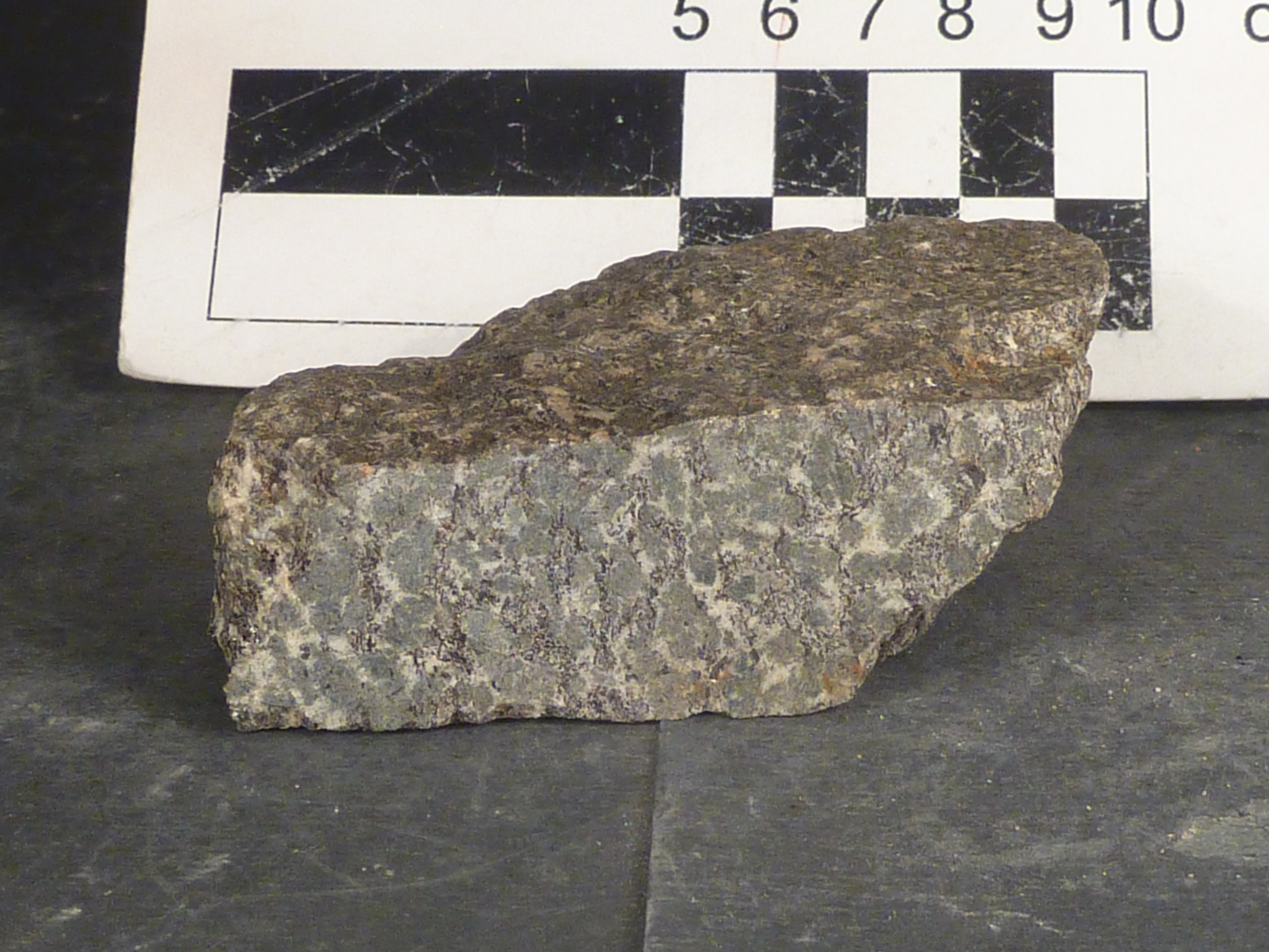
During the I Italian Antarctic expedition (1985/86), 853 rocks have been sampled within the aim of the project "Geological, structural, petrological and geochemical research programme" in northern Victoria Land. They include intrusive, subvolcanic, volcanic, metamorphic and sedimentary rocks. The investigated regions are within Coulman Island SS 58-60/6, Mount Melbourne SS 58-60/9, Mount Murchison SS 58-60/5, Reeves Nevé SS 55-57/12, Relief Inlet SS 58-60/13 and Sequence Hills SS 55-57/8 USGS sheets.
-
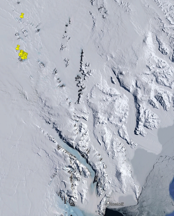
During the XV and XVII Italian Antarctic expeditions (1999/2000, 2001/02), 19 rocks have been sampled within the aim of the project "Concentration of meteorites: identification, collection, study" in northern Victoria Land. They include intrusive rocks and tephra. The investigated regions are within Freyberg Mountains SS 58-60/1 and Welcome Mountain SS 55-57/4 USGS sheets.
-
During the XXI Italian Antarctic expedition (2005/06), 139 rocks have been sampled within the aim of the WISE project in northern Victoria Land. They include intrusive, subvolcanic, volcanic and metamorphic rocks. The investigated regions are within Cape Hallett SS 58-60/2, Daniels Range SR 57-58/14, Freyberg Mountains SS 58-60/1, Mount Soza SR 57-58/15, Ob' Bay SR 57-58/11 and Pomerantz Tableland SR 57-58/10 USGS sheets. Project: Wilkes Basin/Transantarctic Mountains System Exploration.