Rocks from the project “Backside of the Transantarctic Mountains" (BACKTAM)
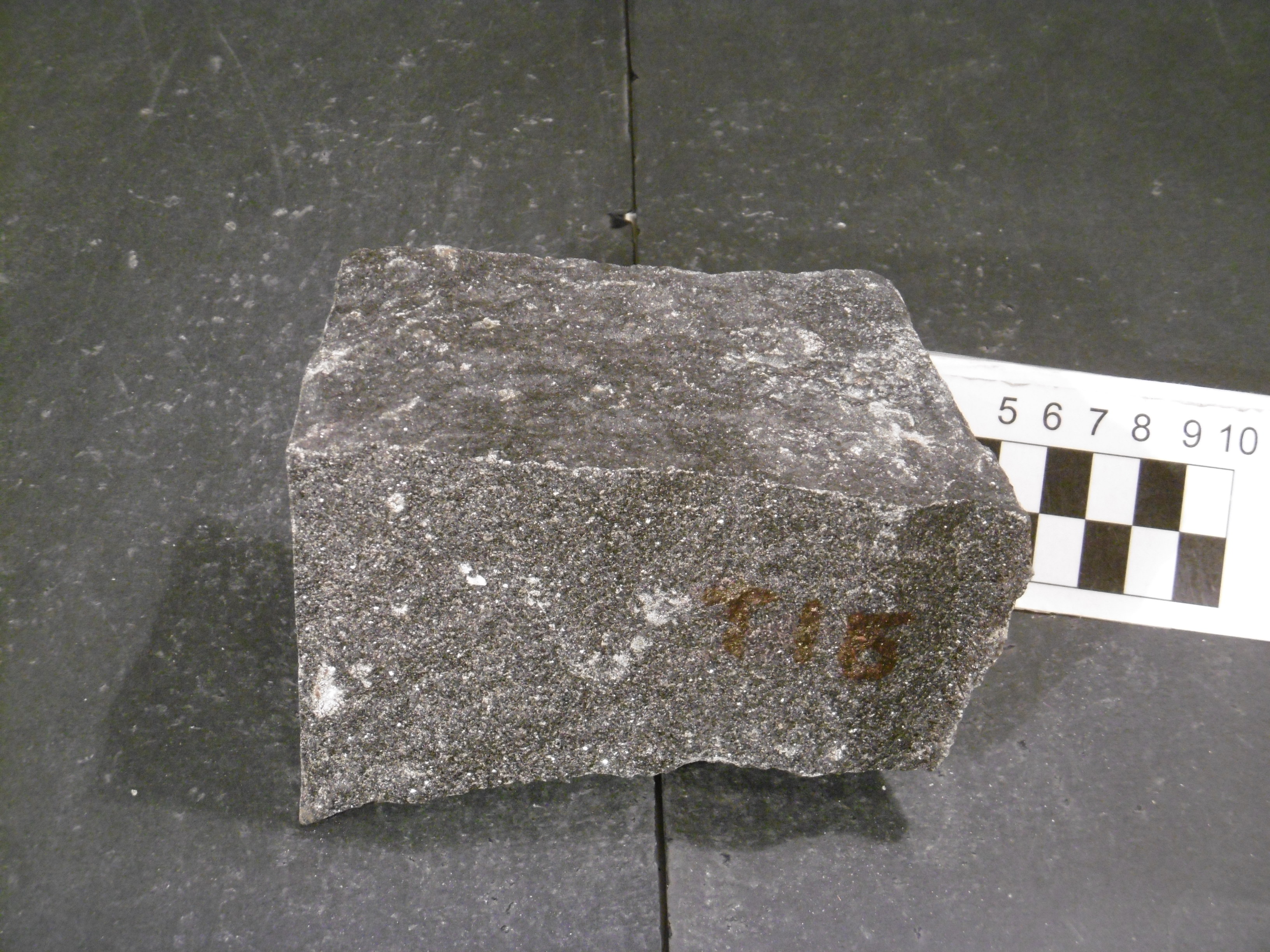
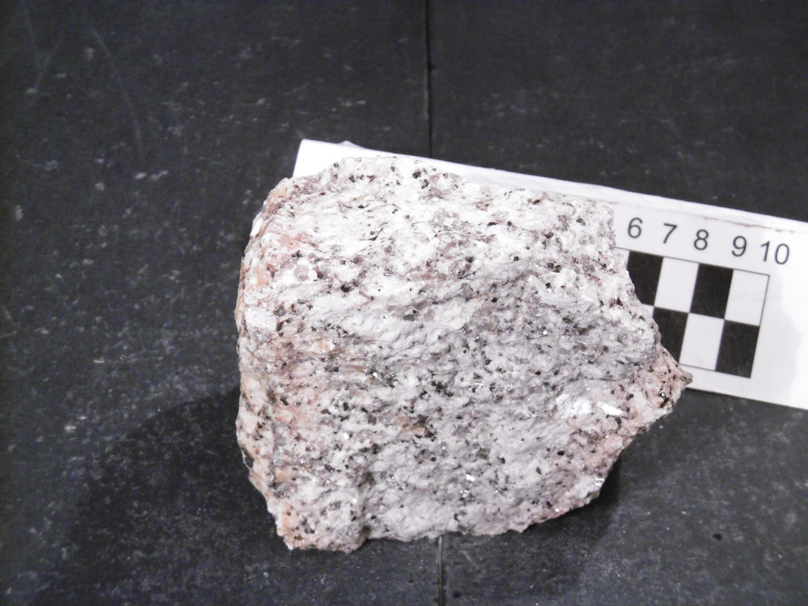
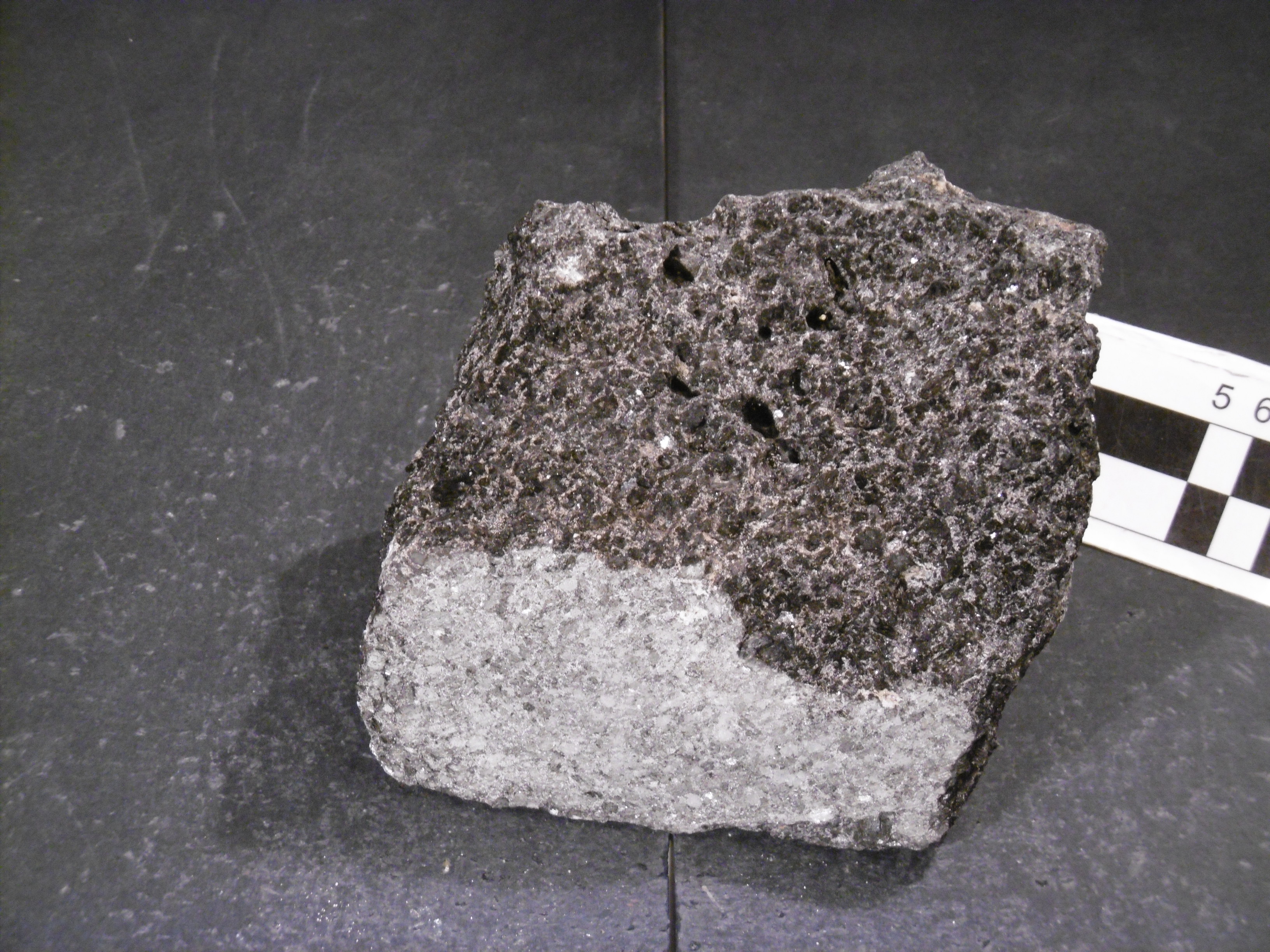
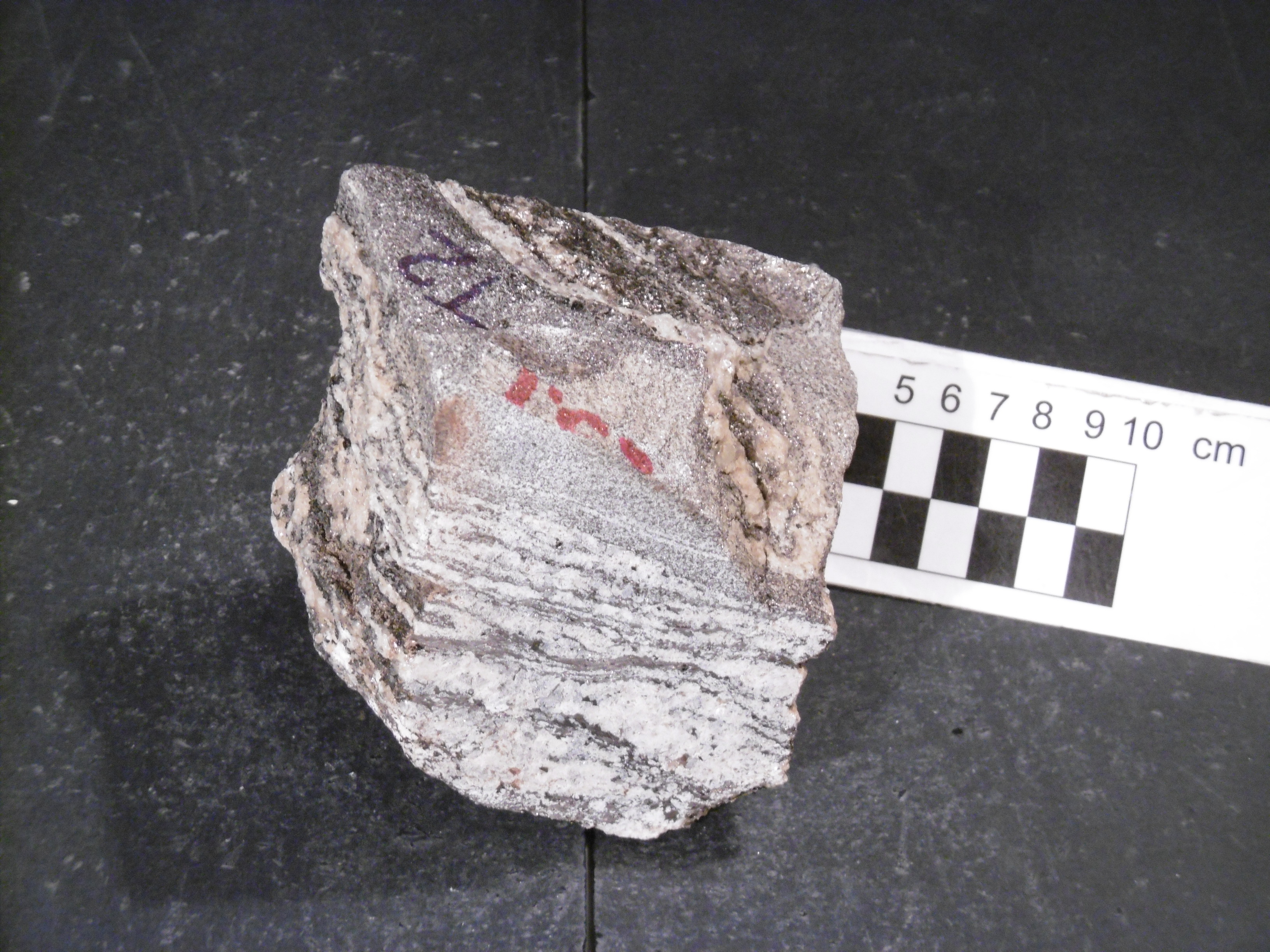
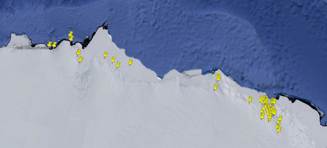
During the XV Italian Antarctic expedition (1999/2000), 213 rocks have been sampled within the aim of the BACKTAM project in Oates Land and George V Land. They include intrusive, subvolcanic, volcanic, metamorphic and sedimentary rocks. The investigated regions are within Australian Antarctic Territory - Ross Dependency - Sr57-58, Australian Antarctic Territory - Sq55-56, Australian Antarctic Territory - Sr55-56 and Australian Antarctic Territory - Terre Adelie - Sq53-54 sheets.
Project: Backside of the Transantarctic Mountains.
Simple
- Date (Creation)
- 2021-10-01
- Purpose
-
The collection is sorted towards Italian and foreign researchers for geoscience studies.
- Status
- On going
- Maintenance and update frequency
- As needed
-
GEMET - INSPIRE themes, version 1.0
-
-
Geology
-
-
GCMD - Science Keywords
-
-
METAMORPHIC ROCKS
-
SEDIMENTARY ROCKS
-
IGNEOUS ROCKS
-
-
NASA Thesaurus
-
-
rocks
-
-
Lithology
-
-
Igneous material
-
Amphibolite
-
Arenite
-
Basalt
-
Clastic sedimentary rock
-
Basaltic rock
-
Dioritic rock
-
Calc-silicate rock
-
Diorite
-
Fault rock
-
Gneiss
-
Granite
-
Granitic rock
-
Metamorphic rock
-
Granulite
-
Granodiorite
-
Marble
-
Metasiliciclastic sedimentary rock
-
Metacarbonatic rock
-
Mica schist
-
Migmatite
-
Migmatic rock
-
Mylonite
-
Phyllite
-
Orthogneiss
-
Pyroxenite
-
Pegmatite
-
Plutonic rock
-
Quartz arenite
-
Schist
-
Sandstone
-
Quartzite
-
Sedimentary rock
-
Ultramafic rock
-
Tonalite
-
Volcanic rock
-
Dolerite
-
Metagabbro
-
-
GCMD - Instruments
-
-
Grabbers/Traps/Collectors
-
-
GCMD - Locations
-
-
ANTARCTICA
-
-
SCAR Gazetteer of Antarctica
-
-
Exiles Nunataks
-
Wilson Hills
-
Cape Denison
-
Eld Peak
-
Garnet Point
-
George V Land
-
Aurora Peak
-
Oates Land
-
Coombes Ridge
-
Cape Pigeon Rocks
-
Cape Bage
-
Berg Mountains
-
Anxiety Nunataks
-
Magga Peak
-
Correll Nunatak
-
DeRemer Nunataks
-
Drury Nunatak
-
Mount Blowaway
-
Mount Martyn
-
Reynolds Peak
-
Rescue Nunatak
-
Harald Bay
-
Ringgold Knoll
-
Burnside Ridges
-
Mount Dalton
-
Mertz Glacier
-
Mount Archer
-
Mawson Peninsula
-
Penguin Point
-
Cape Webb
-
Cape Hunter
-
Lazarev Mountains
-
Scar Bluffs
-
Thomson Peak
-
Ninnis Glacier
-
-
GCMD - Providers
-
-
IT/PNRA
-
IT/MNA
-
-
Research Organization
-
-
MNA - Museo Nazionale dell'Antartide
-
- Use limitation
- Creative-Commons CC-BY 4.0
- Association Type
- dependency
- Initiative Type
- Campaign
- Spatial representation type
- Text, table
- Denominator
- 1
- Language
- English
- Character set
- UTF8
- Topic category
-
- Geoscientific information
))
- Begin date
- 2000-01-23
- End date
- 2000-02-26 Now
- Unique resource identifier
- WGS84
- Distribution format
-
-
XLS
(
1
)
-
KLM
(
1
)
-
XLS
(
1
)
- OnLine resource
-
GeoData
(
WWW:LINK-1.0-http--link
)
Database for the rock samples taken during the PNRA expeditions since the 1985 and preserved at the repository of the Museo Nazionale dell'Antartide.
- OnLine resource
-
Project: BACKTAM
(
WWW:LINK-1.0-http--link
)
Backside of the Transantarctic Mountains
- Hierarchy level
- Dataset
Domain consistency
Conformance result
- Date (Publication)
- 2010-12-08
- Explanation
-
This data set is conformant with the INSPIRE Implementing Rules for the interoperability of spatial data sets and services
- Pass
- Yes
- Statement
-
Samples are stored in cardboard boxes inside metal cabinets in the MNA repository. Samples were weighed, photographed and magnetic susceptibility was measured. Slices were cut to make thin sections.
- File identifier
- 0f7f4b16-42ba-46ab-bf72-d46dac40f2fb XML
- Metadata language
- English
- Character set
- UTF8
- Hierarchy level
- Dataset
- Date stamp
- 2024-10-07T08:17:50
- Metadata standard name
-
ISO 19139
- Metadata standard version
-
1.0
Overviews
Spatial extent
Provided by